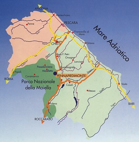
By having a look at the map it is easy to find it, the distance to the
main towns of the region can be calculated by taking into account the fact
that 1 cm corresponds around 6,5 miles .
In yellow you can see the motor-ways A14 Bologna-Bari (north-sout),
A4 Chieti-Roma (east-west), in orange you will trace the main roads that
link Chieti to Guardiagrele and Val di Sangro to Casoli.
Pennapiedimonte is 22 miles distant from Chieti, 30 miles from Pescara,
22 miles from Lanciano, 42,5 miles from Vasto, 22 miles from Ortona, 22
miles from Val di Sangro, 6,5 miles from Guardiagrele, and 156 miles from
Rome.
-
This map is from the pocket-book "Conoscere Pennapiedimonte",
printed by the "Comune di Pennapiedimonte".
-